
01
Home
Your day before heading out
Home is the check before you leave. Readiness, the last outing, and the day ahead sit together on the phone.
Apple-native hiking · Pilot 2026
Prepare before the trail, record with local-first reliability, and carry clear safety context when a handoff matters — built natively for iPhone on iOS 26 and later, with Apple's Liquid Glass design.
Pilot access is limited. Selected hikers test real outdoor scenarios through TestFlight.
On-device recording

Session
On device
Recording
Active
Handoff
You review
iPhone recording screen
iPhone on iOS 26. Private pilot of the native app. It requires iOS 26 or later.
Reviewed, then invited. We use these answers only to review your application. Read the Privacy Policy (opens in a new tab).
Updates stay separate. Launch updates are email only, and are not a pilot application.
The field system
Venturize does not wait for a problem to tell you what is missing. It checks the pieces that matter before the trail starts.
Saved trail context remains local.
Device GPS can continue without mobile data.
Contacts and privacy choices are reviewed before departure.
Compact route-aware context is prepared for a handoff.
The route
Home, Explore, a live recording, then the saved route, the journal, and your trail story — the same order as the hike.
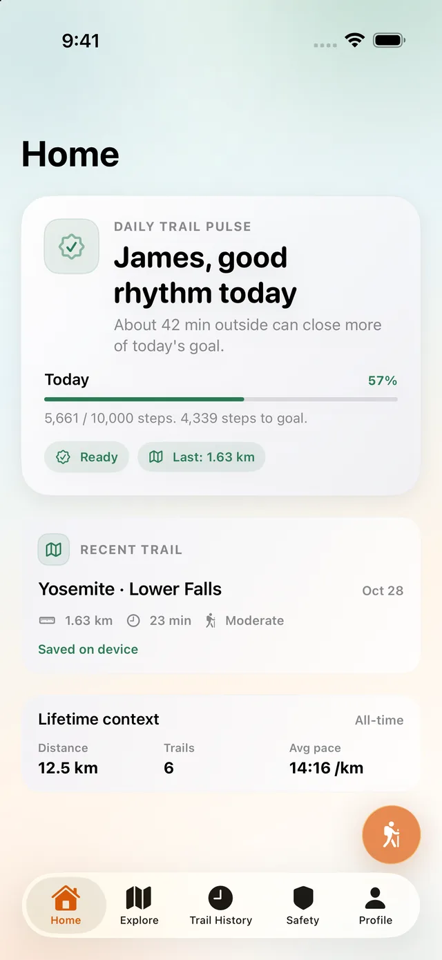
Step 1: Home. Your day before heading out
01
Your day before heading out
Home is the check before you leave. Readiness, the last outing, and the day ahead sit together on the phone.
02
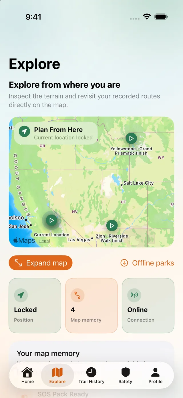
Plan from where you are
Explore opens from your current location, with the terrain and offline parks available while you still choose the line.
03
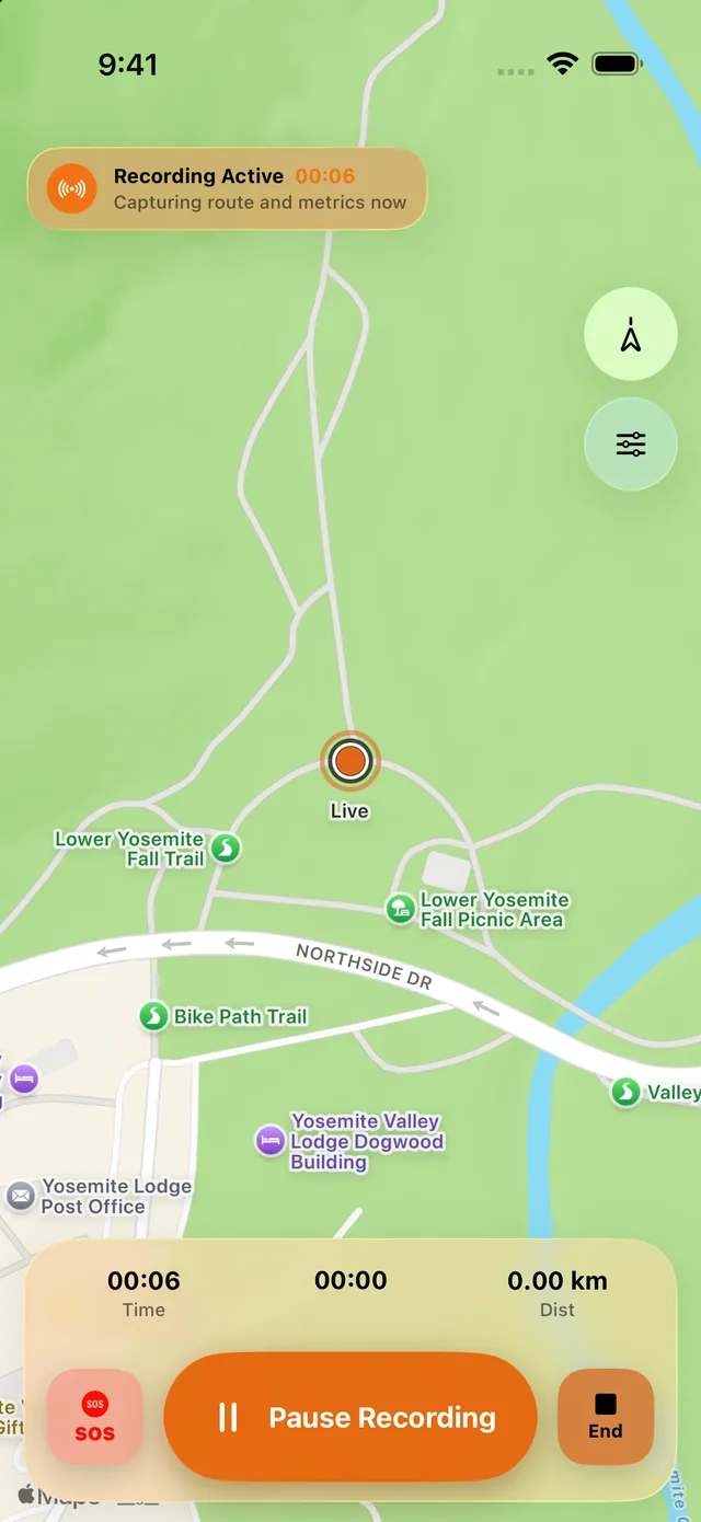
Live route recording
Once the outing starts, the route records on the iPhone. Time, distance, pause, end, and SOS stay on screen while recording is active.
04
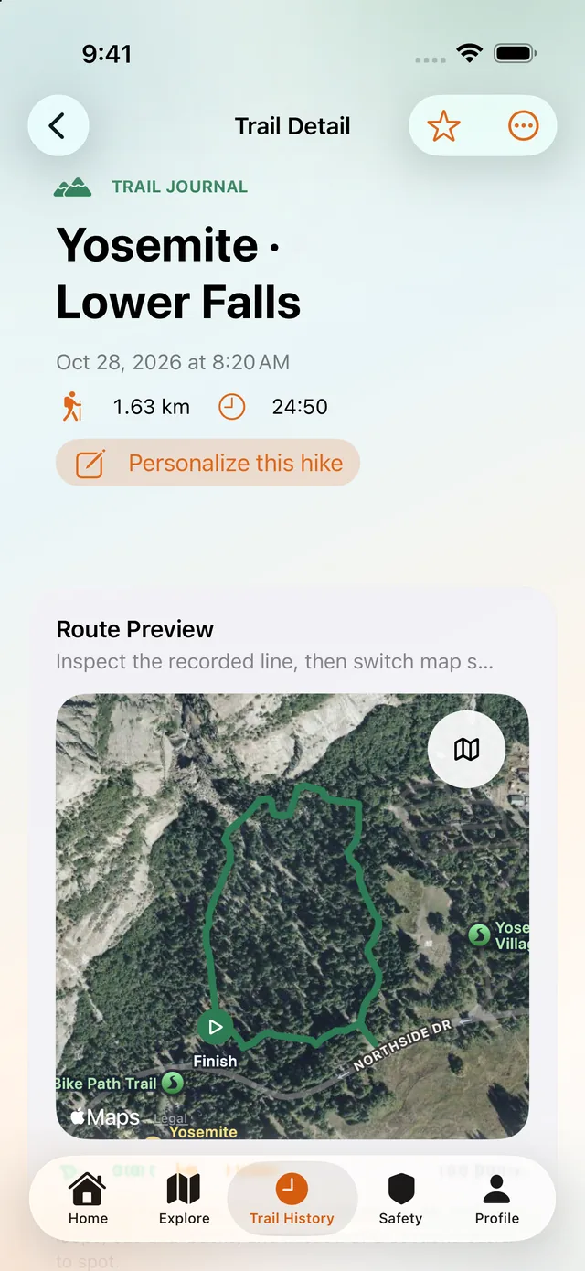
Review the recorded route
Trail Detail opens the line that was saved. This screen is Yosemite · Lower Falls, drawn on satellite so you can review that route.
05
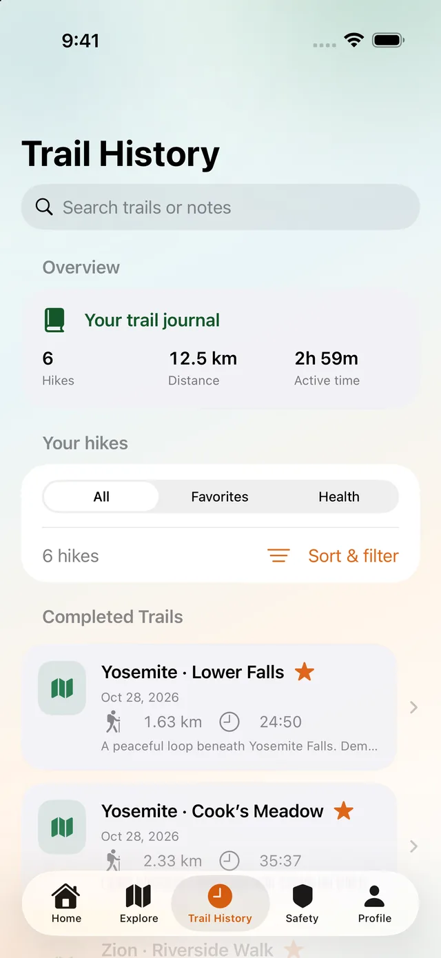
Your trail journal
Trail History is the journal of completed hikes, including Yosemite outings, ready to search and open again.
06
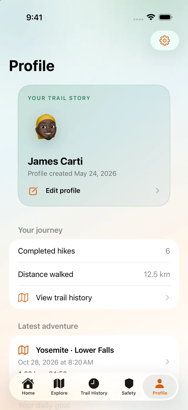
Your trail story
Profile holds the trail story already stored on the phone: the journey so far and the latest outing.
The private pilot runs on iPhone and requires iOS 26 or later.
Apply for Trail Pilot 2026Venturize Offline Park Packs are being designed for selected parks: verified local map context, trail geometry, safety points, and clear attribution — prepared before the hike and available when data is not.
Verified local map context, trail geometry, and safety points are prepared while you still have data.
Each pack is checked on your iPhone before you rely on it.
Local context stays available when the network does not.
Offline Park Packs are in controlled field testing and are not yet part of general pilot access. Availability will vary by park and build.
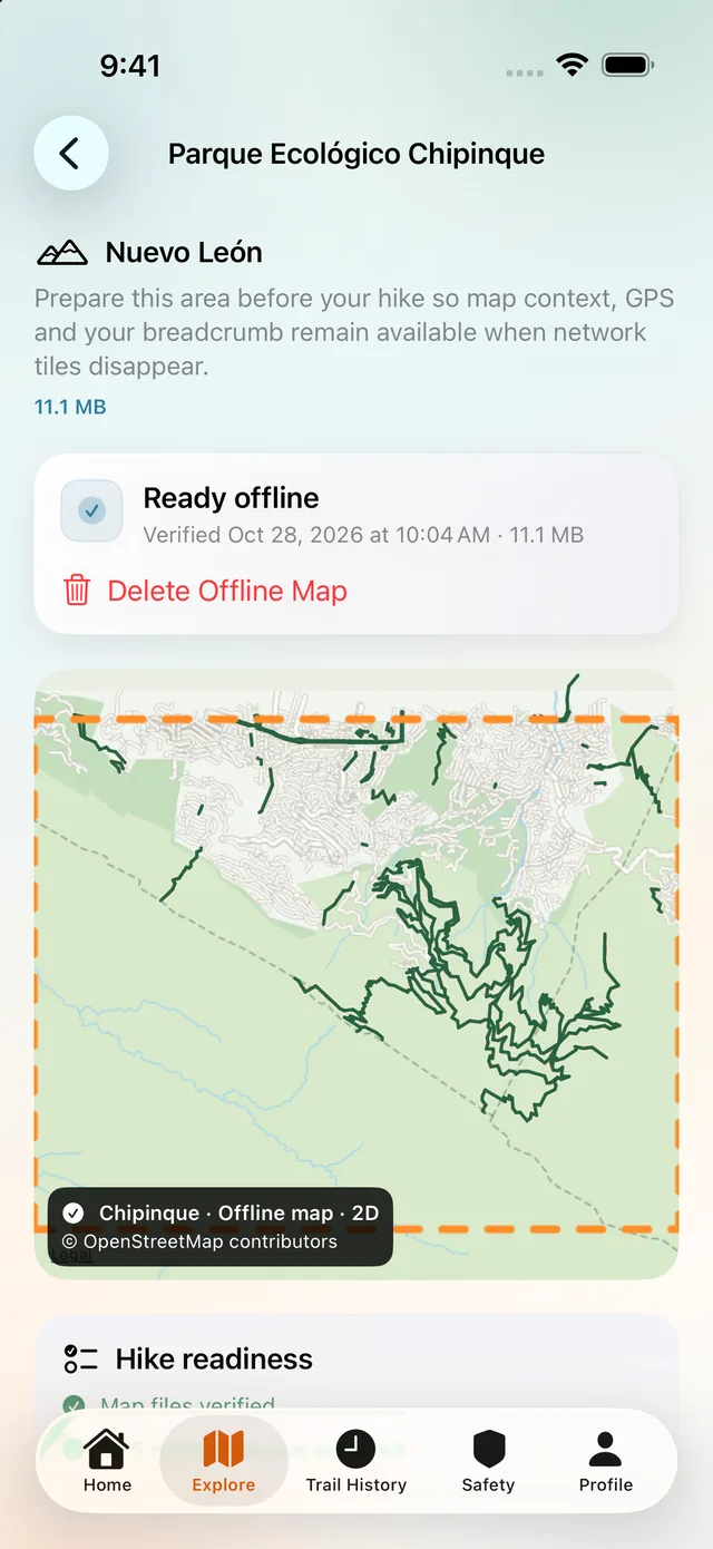
Chipinque offline map ready, download region marked
SOS
Venturize prepares a Messages draft with your contacts, coordinates, and map links. Venturize never contacts emergency services or sends anything by itself. The hiker always taps Send. The draft can ask your contacts to contact emergency services if you do not respond.
01
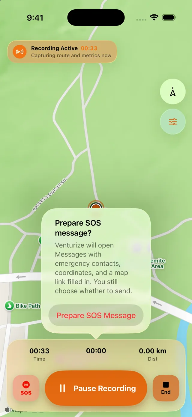
Prepare SOS message
During a live recording, Prepare SOS message explains the next step. Venturize will open Messages with emergency contacts, coordinates, and a map link filled in. You still choose whether to continue.
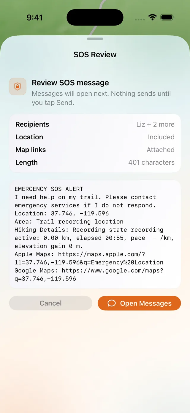
02
SOS Review
SOS Review shows the drafted message before Messages opens, including coordinates and map links. Nothing sends until you tap Send.
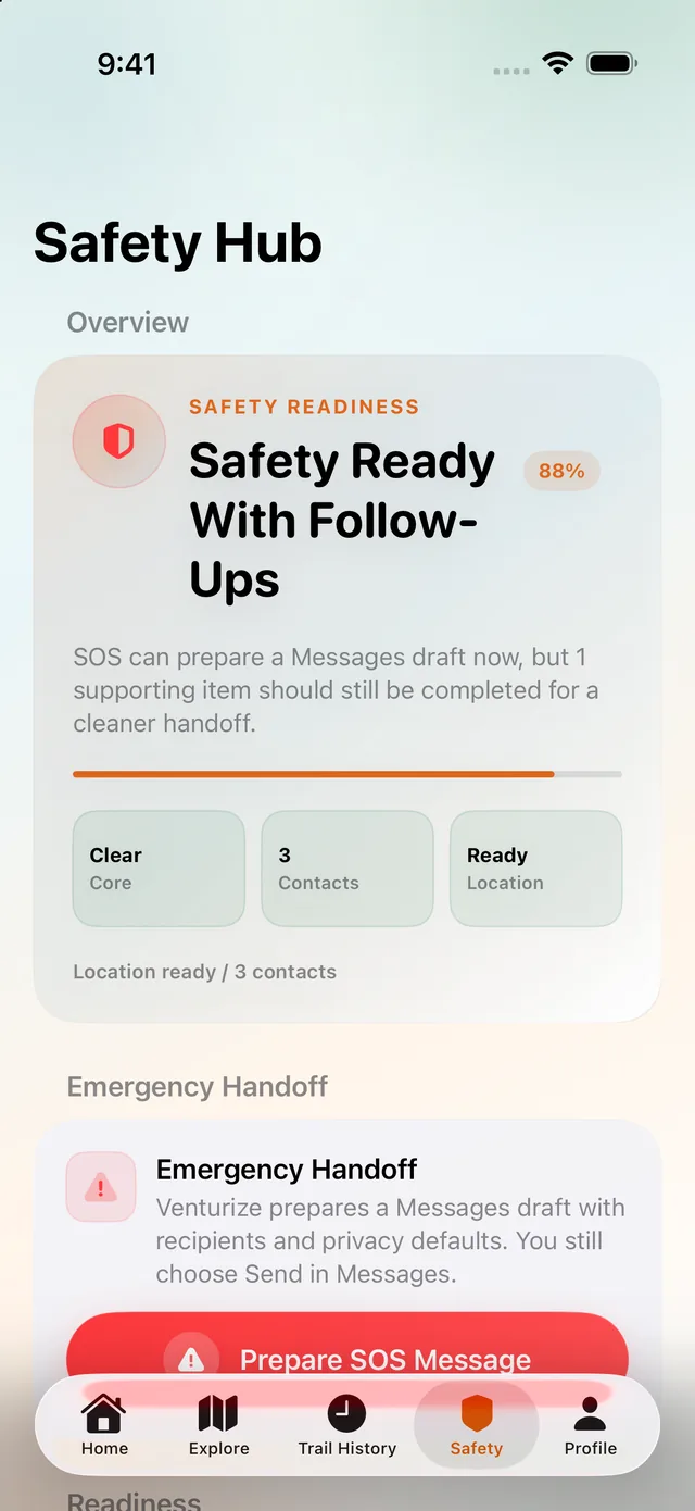
03
Safety Hub
Safety Hub shows handoff readiness, including follow-ups that are still open. Preparing a draft here does not send it.
Venturize never contacts emergency services or sends anything by itself. The hiker always taps Send. This does not replace emergency services or proper preparation.
Emergency SOS via satellite is an Apple system feature on supported devices and regions. Venturize does not independently transmit satellite SOS messages. SOS Capsule and Satellite Assist remain readiness and handoff guidance.
Recording
When connectivity drops, Venturize falls back honestly: GPS breadcrumb, time, distance, pause, resume, and end session all keep working.
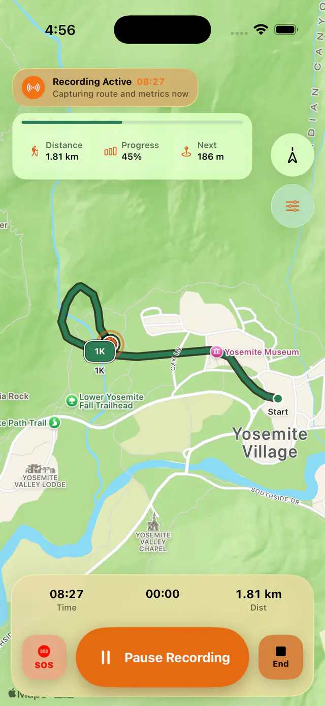
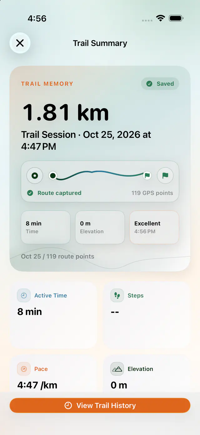
Local session checkpoints support interruption recovery.
Map availability never becomes a requirement to continue recording.
Completed trails flow into Summary, History, and Trail Detail.
Trust
Trail sessions and readiness state live on your device during the pilot.
Clear offline, denied-permission, and unavailable states instead of silent failure.
Nothing leaves the app before you review it. Every handoff is a deliberate action.
Broader beta claims wait for evidence from real iPhones on real trails.
In the pilot
Once the outing starts, the route records on the iPhone. Time, distance, pause, end, and SOS stay on screen while recording is active.
In the pilot
Trail Detail opens the line that was saved. Trail History is the journal of completed hikes.
In the pilot
During a live recording, Prepare SOS message drafts a Messages handoff. Nothing sends until you tap Send.
Field testing, guidance only, or not part of the iPhone pilot.
Field testing · Chipinque first
Offline Park Packs are in controlled field testing and are not yet part of general pilot access. Availability will vary by park and build.
Not in this pilot
The pilot is the iPhone app. The application asks whether you have an Apple Watch so we know what you carry on the trail. There is no Apple Watch feature.
Readiness and handoff guidance
SOS Capsule remains readiness and handoff guidance. It is not a message Venturize sends.
Readiness and handoff guidance
Satellite Assist remains readiness and handoff guidance. Venturize does not independently transmit satellite SOS messages. Emergency SOS via satellite is an Apple system feature on supported devices and regions.
Trail Pilot 2026
Venturize is a private pilot of an Apple-native iPhone hiking app. It uses Apple's Liquid Glass design.
Send a Trail Pilot application from this page.
We read your application. Applying does not mean you are selected.
If you are selected, we email a TestFlight invitation.
Requires an iPhone on iOS 26 or later.
Email only. We use it to send launch updates — not to review you for the pilot. Unsubscribe, or ask for deletion, by emailing support@venturize.app.
FAQ
Venturize is an Apple-native hiking app designed to help you prepare for the trail, record your hikes, and keep important route and safety information available on your iPhone.
It brings together GPS route recording, trail history, activity summaries, and user-controlled SOS message preparation.
Venturize is currently in a limited private pilot, where we're testing reliability, usability, and real-world performance before a wider release.
Pricing for the public release hasn't been announced yet.
Applying for the private Trail Pilot does not require a purchase. Any future pricing or subscription plans will be communicated before launch.
The current private pilot is designed for compatible iPhones running iOS 26 or later.
Apple Watch functionality is not included in this pilot. Device compatibility and feature availability may change as development progresses.
Submit your application through our website. We review applications based on device compatibility, hiking experience, and the testing scenarios we're currently evaluating.
Selected applicants receive an invitation through Apple's TestFlight platform to install and test a prerelease version of Venturize.
Invitations are distributed in stages. We cannot guarantee acceptance or a specific response date.
Venturize is designed to continue recording GPS-based route information when cellular data is unavailable.
Your iPhone can receive GPS positioning without an internet connection, although accuracy depends on location conditions, satellite visibility, and device permissions.
Map imagery and other online services may become unavailable without connectivity. Offline Park Packs are being tested separately, beginning with Parque Ecológico Chipinque, and are not yet included in general pilot access.
Offline recording reliability is an important part of our ongoing field testing.
No. Venturize does not automatically call emergency services, dispatch rescuers, or send emergency messages.
The Safety Hub can prepare an SOS message draft containing relevant location and route information for you to review. You decide whether to send it using Apple's messaging capabilities.
Sending a message requires an available and supported communication method. Apple's satellite emergency features operate independently of Venturize.
Venturize is a hiking support tool, not an emergency response service or a replacement for proper outdoor preparation.
No. An Apple Watch is not required to participate in the Trail Pilot.
The current pilot focuses on the iPhone experience. Apple Watch capabilities are being considered as part of the broader development roadmap but are not included in the current testing release.
Venturize follows a local-first approach.
During the pilot, recorded trails, route history, emergency contacts, and safety preferences are stored on your iPhone by default. Your route recordings are not automatically uploaded to Venturize servers.
When you apply for the Trail Pilot, we separately collect the information you submit, including your name, email, region, iPhone model, iOS version, hiking frequency, device information, and optional testing preferences. We also retain a record of your consent.
Application information is used to review candidates, manage invitations, and contact selected participants. Launch-update subscriptions are managed separately.
To request deletion of your application information or unsubscribe from launch updates, contact support@venturize.app.
For more information, read our Privacy Policy.
Our initial field tests are focused on Monterrey, Nuevo León, Mexico, beginning with Parque Ecológico Chipinque.
Applications from other regions can be submitted, but participation outside our initial testing area is not guaranteed.
We have not announced a wider regional rollout or an international public release date.
Venturize is an independent software project founded in Monterrey, Mexico, and developed by a small team focused on native Apple experiences.
Our goal is to build a reliable hiking companion that combines thoughtful design, on-device functionality, and practical safety tools.
We're developing Venturize incrementally, validating its capabilities on real devices and real trails before expanding access.